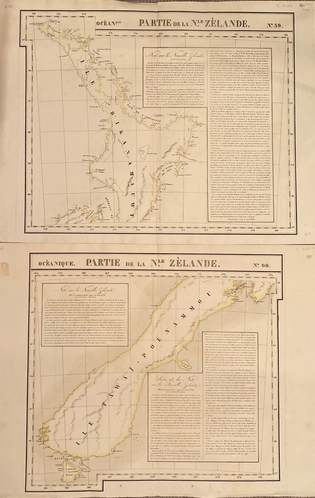
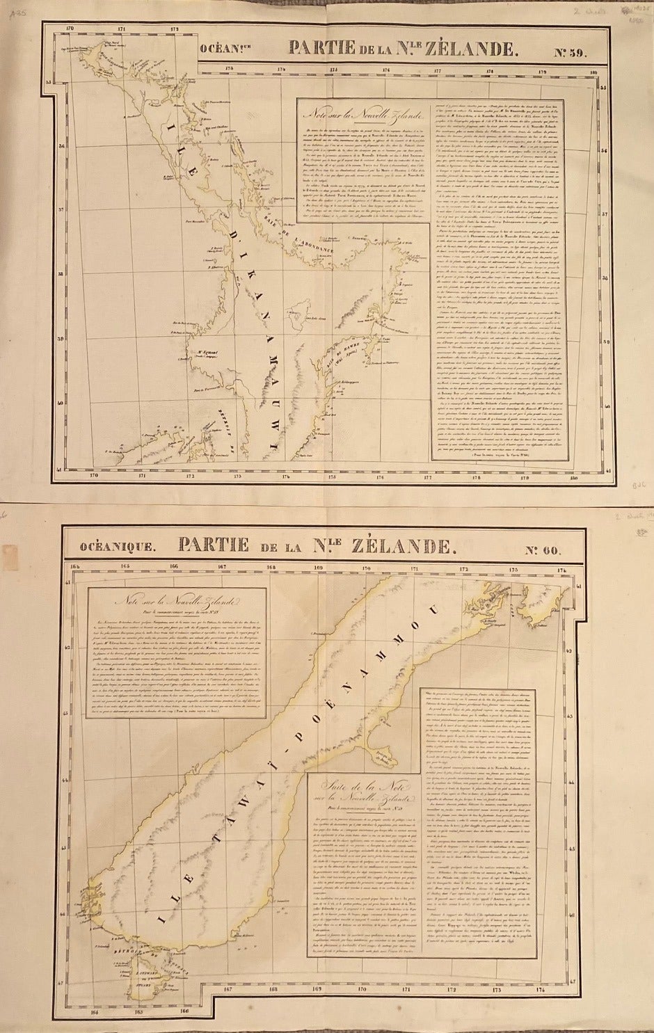
Oceanique. Partie de la Nle. Zelande. maps No. 59 and 60
Bruxelles: Vandermaelen, 1827. Unbound. Two rare hand-coloured lithographed maps of Mew Zealand showing the North Island with top of the South Island, and the South Island with Stewart island. Image size 53.5 x 48 cm, overall 72 x 53 cm. Small tears at margin on centre fold not affecting the image. The map was first published in the Atlas Universel de Geographie, and has an extensive text describing features of New Zealand and Maori. Fine copies with full margin, not all trimmed as is often the case. Free floating. Very Good, Item #019025
Price: $4,655.00 NZD
See all items in
Books,
New Zealand
See all items by Philippe VANDERMAELEN