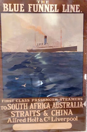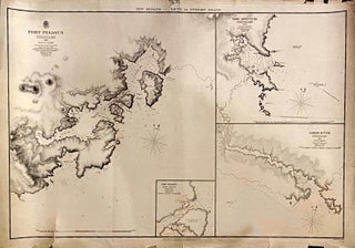
Port Pegasus. New Zealand South or Stewart Island. 1849
London: Admiraty Charts, Hydrographic Office, 1861. No Binding. Original survey map of the Port Pegasus coastal region of Stewart Island. Insets include Port Pegasus anchorage, Port Adventure and Lord's River. The map shows soundings, the survey based on that of Capt. Stokes on the Acheron, in the years 1849 to..... More