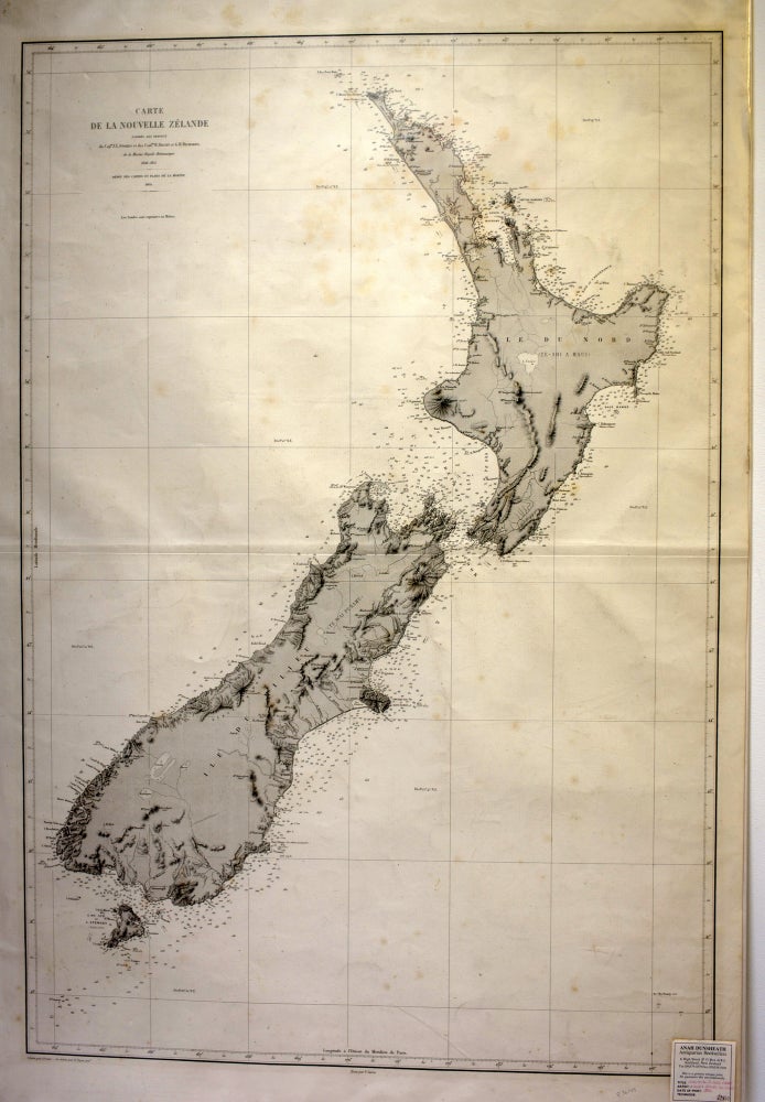
New Zealand survey map. Carte de la Nouvelle Zelande
V Carre, 1864. No Binding. Size including margins: 102 x 67.5 cm. Minor yellowing in one area. Survey map of New Zealand based on the charts of the British Royal Marines (Capt. Stokes, Commodores Drury and Richards) during the years 1848-1855. Engraved by Grenier. A rare, important and early survey map showing data for the whole of the coasts of the three islands. Very Good. Item #017424
Price: $2,090.00 NZD
See all items in
Books,
New Zealand
See all items by Drury Stokes, Richards