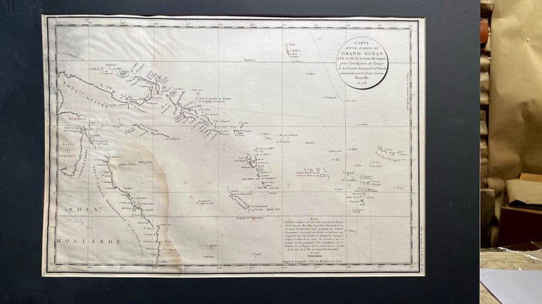
Carte d'une Partie du Grand Ocean a l'E et SE e la Nouvelle Guinee
No Binding. Map from the Atlas du Voyage de la Perouse No. 68. Shows New Guinea, NE coast of Australia, New Caledonia, Fiji, Friendly Islands, etc., showing the route of the Spanish frigate La Princessa commanded by Maurelle in 1871. The account of this voyage was obtained by La Perouse in China during his voyage (1785-88, when he disappeared) and sent back to France with his own journals. An attractively designed map. Pale stain on left hand side. 51 x 35 cm in mount 66 x 56 cm. Fair. Item #018428
Price: $522.50 NZD
See all items by La Perouse