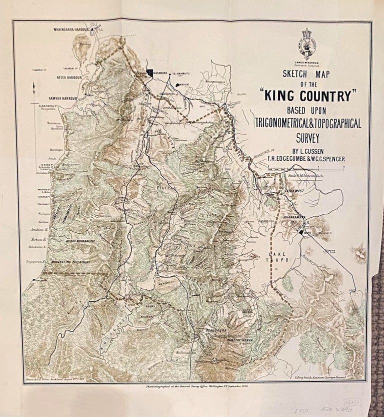
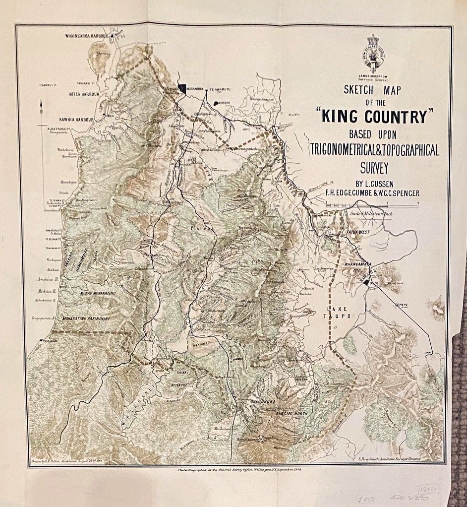
Sketch Map of the 'King Country' based upon Trigonometrical & Topographical Survey by L. Cussen, F.H.Edgecumbe & W.C.C.Spencer
Wellington: General Survey Office, 1884. C R Pollen. No Binding. Original photolithograph of the King Country from Whaingaroa Harbour in the North West to Mt Ruapehu in the Central Volcanic Plateau. Issued during the time of Percy Smith as Asst. Surveyor General. Shows great geographic and topographic detail, and district boundaries. 42 x 39 cm. Excellent clean copy of an historically interesting map. Very Good. Item #018634
Price: $315.88 NZD
See all items in
New Zealand