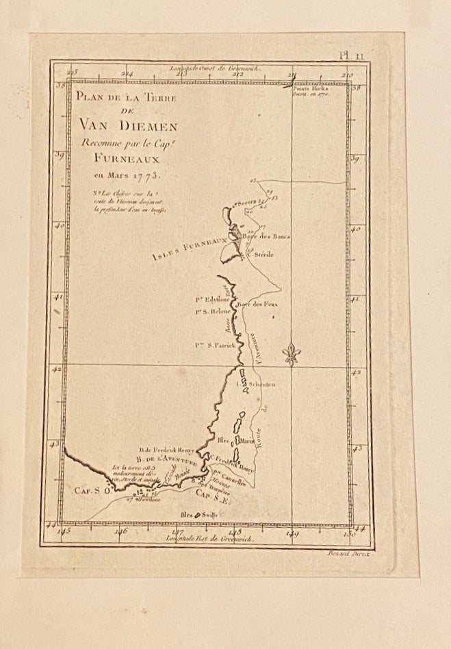
Plan de la Terre de Van Diemen
No Binding. Single page from a mid 1770s French edition of Cook's second voyage, 21 x 27.5 cm, mounted on card 25 x 22.5 cm. Map of the south eastern corner of Tasmania, showing the route of Furneaux's ship in March 1773 with numbers denoting the depth in fathoms from their soundings. Tobias Furneaux commanded the Adventure on Cook's second voyage, which included mapping this part of Tasmania. Although Furneaux made a number of mistakes in his sightings, Cook visited the same area on his third voyage, confirming features that retain their names today. Very Good. Item #019358
Price: $188.62 NZD